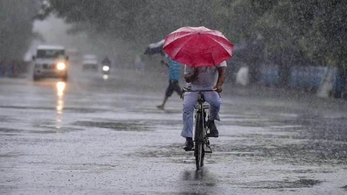
Another Warm Day In Delhi-NCR, Storm May Bring Relief Soon
Strong winds set in over the Capital and its adjoining areas late on Tuesday with weather department officials predicting high chances of thunderstorm and rain overnight, bringing much-needed respite from a hot spell that, coupled with high humidity, drove heat to dangerously high levels.
The Capital recorded a maximum of 43.5°C on Tuesday, 0.2 degrees lower than Monday’s peak, but there was little difference in how hot the day felt since high humidity meant the heat index clocked in at a scorching 49°C in the afternoon. The city’s night temperature was also the highest for the year, clocking in at 29.8°C.
But the India Meteorological Department (IMD) forecast turn in the weather starting from late on Tuesday, when effects of a western disturbance was predicted to take hold. The official forecaster issued a yellow alert for Wednesday for several regions, including Haryana, Chandigarh, Delhi, West Uttar Pradesh and north Rajasthan, asking people to take precaution from stormy weather.
The Met, in these regions, advised people to stay indoors with windows and doors shut, and avoid travel if possible, during the storm. It also advised against taking shelter under trees, and recommended that electrical or electronic appliances be unplugged.
The reason for the warnings is because a western disturbance lying over Iran and the neighbourhood, and a cyclonic circulation developing over central Pakistan in lower tropospheric levels will likely trigger storms as move across northwest India from May 23 to 26, IMD said.
“This is an active western disturbance which is likely to bring weather to the plains and higher elevations over northwest India. We issued a special message because thunderstorm and lightning are expected. It will be similar to wet spells we saw in March and April in association with western disturbances. Rainfall is expected both over Uttarakhand and Himachal Pradesh and Punjab and Haryana. Light to moderate rain is likely over Delhi also. Maximum temperatures are expected to drop during these four days,” said RK Jenamani, senior scientist, IMD.
“Rainfall is likely most places with thunderstorm, lightning and occasional gusty winds or squall over the Western Himalayan region and rainfall at many places with thunderstorm, lightning, gusty winds/squall is very likely over plains of northwest India mainly from May 23 to 26 with maximum intensity on May 24 and 25,” the IMD forecast said.
As a result, the maximum temperatures in the Capital region that has been around 44°C for the past one week will fall to near or below 40°C, the Met added.
“We will see light rain on Wednesday, accompanied by gusty winds. On Thursday, light to moderate showers are expected, with gusty winds touching 50 kmph in places,” said Kuldeep Srivastava, scientist at IMD.
Tuesday’s maximum of 43.5°C was recorded at the Safdarjung observatory, which provides the representational data for Delhi. Other parts of the city were even warmer — the station at Najafgarh logged a high of 46.7°C, followed by 46.2°C at the Sports Complex station (Akshardham). Gurugram and Noida too were warmer, both with a high of 44.2°C.
The hot and humid weather led to a rise in power demand, which touched a peak of 6,916 MW — the highest so far this year, slightly above the peak of 6,532 MW on Monday.
Heat index, or the “real feel” temperature is a closer representation of how hot a person will feel since humidity impairs the effect of sweating, making it harder to cool down naturally.

